
Steps in digitizing a map in ArcGIS
I will guide you step by step here to make it easy for you. After digitizing our map will look like this.

Open ArcGIS and Select Add data in ArcGIS.


Then Map has to do Georeferencing and i have uploaded the method of Georeferencing so you can check it from my blog and Georeferencing Completed.
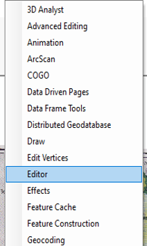
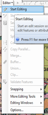
Right Click anywhere and Click editor option
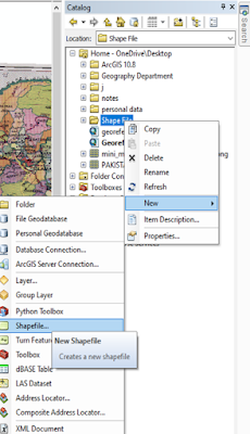
Select Catalog and and make a new shape file


Right Click Shapefile and Click new and then Select Option Shape File
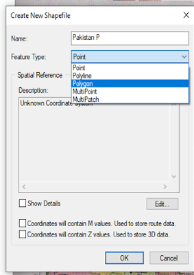
Then Select polygon and Click edit Button Below
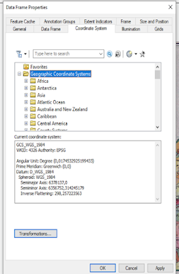
Click Geographic Coordinate System and select on world and select WGS 1984 and click apply and ok
Click Start Editing Option and Select Create Feature

Click File you make and Start Editing and go to single clicking on the Border of the map

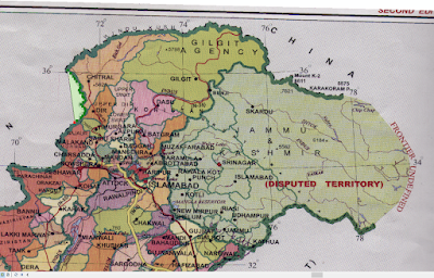
Complete Digitize the map and map will look like something like this


0 Comments